उत्तराखंड जिसे देवों की भूमि-देवभूमि उत्तराखंड के नाम से जाना जाता हैं, हिमालय की तलहटी में स्थित हैं। राज्य के उत्तर में चीन और पूर्व में नेपाल के साथ अंतर्राष्ट्रीय सीमाएँ हैं। इसके उत्तर-पश्चिम में हिमांचल प्रदेश, जबकि दक्षिण में उत्तर प्रदेश है।
उत्तराखंड कई मायनों में एक बेहतरीन जगह हैं, यहाँ हर जगह कुछ दूरी पर आपकों कोई पवित्र स्थल और मंदिर देखने को मिल जाएगा। उत्तराखंड के पहाड़ी क्षेत्र, पर्यटकों एवं तीर्थयात्रियों के लिए आकर्षण का केंद्र हैं। यहाँ की हरी-भरी घाटियाँ, पवित्र नदियाँ, दिव्य तीर्थस्थल, असंख्य वनस्पतियों और जीवों का आवास, मनुष्य को ईश्वर का एक दिव्य उपहार है। वर्षों से उत्तराखंड अनगिनत प्रकृति प्रेमियों, आध्यात्मिक यात्रा पर निकले तीर्थयात्रियों को प्रेरणा एवं आनंद की अनुभूति कराता रहा है, शहरी भाग-दौड़ से परे – उत्तराखंड का शांत वातावरण स्वर्ग की सी अनुभित देता है।
उत्तराखंड का इतिहास
वैसे तो उत्तराखंड का इतिहास अभी का नहीं अपितु कई समय पहले का है, जिसका जिक्र कई हिंदू पुराणों में मिलता है।
पुराणों में केदारखंड (वर्तमान गढ़वाल) और मानसखंड (वर्तमान कुमाऊं) का जिक्र किया गया हैं। पुराणों में, उत्तराखंड मध्य भारतीय हिमालय के लिए प्राचीन शब्द था। इसकी चोटियों और घाटियों को स्वर्ग लोक के रूप में जाना जाता था।
इसके इतिहास को सबसे अच्छे तरीके से गढ़वाल और कुमाउं के इतिहास के माध्यम से समझा जा सकता है।उत्तराखंड में कई राजाओं ने राज किया उसके बाद यहाँ गोरखा, अंग्रेज आए। देश की आजादी के बाद उत्तराखंड ने उत्तरप्रदेश से अलग राज्य उत्तरांचल की लड़ाई लड़ी जिसमें कई लोगों शहीद भी हुए। आखिरकार 9 नवंबर 2000 को उत्तरांचल देश के 27 वे राज्य के रूप में बना। 2007 में उत्तरांचल का नाम बदलकर उत्तराखंड कर दिया गया।
 उत्तराखंड का भूगोल:
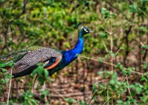
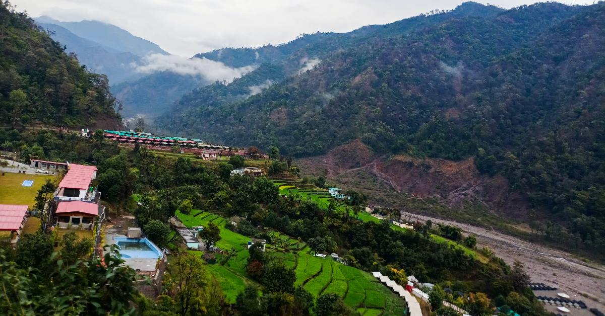
उत्तराखंड राज्य का कुल भूभाग 53,483 वर्ग किलोमीटर का है। उत्तराखंड का ज्यादातर क्षेत्र पहाड़ों और जंगलों से घिरा है। उत्तराखंड की विशिष्ट वनस्पतियों और जीव जंतुओं में बाघ, तेंदुए और असामान्य झाडि़यां और पेड़ शामिल हैं। भारत की दो बड़ी नदियां यमुना और गंगा के उद्गम स्थान राज्य में ही हैं। उत्तराखंड की कई भौगोलिक विशेषताएं हैं जिनमें प्रमुख भौगोलिक विशेषताएं इस प्रकार हैं:
- पहाड़ी झाड़ीदार भूमि और मैदान
- अल्पाइन की झाडि़यां और चराई
- सामान्य शंकुधारी जंगल
- पश्चिमी हिमालय के उप अल्पाइन शंकुवृक्ष जंगल
- पश्चिमी हिमालय के सामान्य पतझड़ी जंगल
- हिमालय श्रृंखला के सबट्राॅपिकल देवदार जंगल
- तराई-दुआर की तराई और सवाना
- अपर गंगा के मैदानों के नम पतझड़ी जंगल
जनसांख्यिकी:
सन् 2011 की जनगणना के अनुसार उत्तराखंड की आबादी 1,00,86,292 है। पिछली जनगणना के मुकाबले यह वृद्धि दर 19.17 प्रतिशत की थी। यहां पुरुषों और महिलाओं का अनुपात 1000:963 है। उत्तराखंड का जनसंख्या घनत्व 189 प्रति वर्ग किलोमीटर है। राज्य की साक्षरता दर 79.63 प्रतिशत है।
 अर्थव्यवस्था:
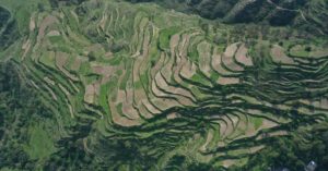
राज्य की अर्थव्यवस्था हाल ही में कुछ तेजी से बढ़ती हुई अर्थव्यवस्थाओं में शामिल है। कृषि उत्तराखंड की अर्थव्यस्था का महत्वपूर्ण आधार है । यहाँ की मुख्य फसलें चावल, सोयाबीन, गेंहू, मूंगफली, दालें, मोटे अनाज और तिलहन हैं। सेब, नाशपाति, संतरा, आडू, प्लम और लीची व्यापक तौर पर उगाए जाते हैं और खाद्य उद्योग का महत्वपूर्ण भाग हैं। राज्य की प्रमुख नगदी फसल गन्ना है। राज्य में पर्यटन का एक बड़ा केंद्र बनने की अपार संभावनाएं हैं। पर्यटन भी इस क्षेत्र में बढ़ रहा है और सालाना आय में योगदान दे रहा है।
 समाज और संस्कृति:
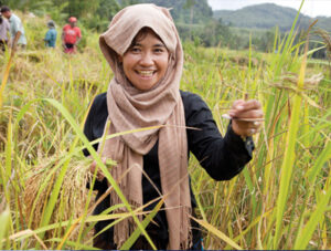
उत्तराखंड राज्य में गढ़वाल और कुमाऊँ की जीवनशैली वहाँ रिवाजों और परंपराओं से समझी जा सकती है। उत्तराखंड में रहने वाले ज्यादातर लोग हिंदू और बौद्ध धर्म से हैं। । संगीत उत्तराखंड की संस्कृति का अभिन्न अंग है। यहां के लोकप्रिय लोक गीतों में बसंती, मंगल, खुदेद और चैपाटी हैं। स्थानीय शिल्प में लकड़ी की नक्काशी प्रमुख है। हिंदू धर्म की सबसे महत्वपूर्ण तीर्थ यात्रा कुंभ मेला हरिद्वार में होता है। इसे विश्व का सबसे बड़ा धार्मिक सम्मेलन माना जाता है। राज्य के अन्य महत्वपूर्ण उत्सवों में घी संक्राति, वट सावित्री, खतरुआ, फूल देई, हरेला मेला, नंदा देवी मेला आदि शामिल हैं।
भाषा:
उत्तराखंड की दो प्रमुख क्षेत्रीय भाषाएं गढ़वाली और कुमाउंनी हैं, लेकिन हिंदी सबसे ज्यादा बोली जाने वाली भाषा है। गढ़वाल और कुमाउं क्षेत्र में क्रमशः गढ़वाली और कुमाउंनी भाषाएं बोली जाती हैं। पश्चिम और उत्तर में कुछ आदिवासी समुदाय जौनसारी और भोटिया बोलियां बोलते हैं। वहीं दूसरी ओर शहरी आबादी ज्यादातर हिंदी भाषा बोलती है जो कि संस्कृत के साथ साथ उत्तराखंड की आधिकारिक भाषा है।
 पर्यटन:
उत्तराखंड पर्यटन के लिए एक बहुत अच्छी जगह हैं। चाहे वो प्रकृति, वन्यजीवन, एडवेंचर या तीर्थ स्थल कुछ भी क्यों ना हो। यहां के प्रमुख स्थानों में हरिद्वार, ऋषिकेश, देहरादून, मसूरी, अल्मोड़ा, केदारनाथ, बद्रीनाथ, यमुनोत्री, गंगोत्री, जिम काॅर्बेट नेशनल पार्क नैनीताल, रानीखेत और पिथौरागढ़ हैं। यहाँ हाई या लो एल्टीट्यूड की ट्रेकिंग, रिवर राफ्टिंग, पैरा ग्लाइडिंग, हेंग ग्लाइडिंग, पर्वतारोहण, स्कीइंग या दूसरी कई गतिविधियां कर सकते हैं।
उत्तराखंड के राज्य चिन्ह, पुष्प, पशु, पक्षी:
राज्य-चिह्न – उत्तराखंड का राज्य चिन्ह
राज्य पुष्प- ब्रह्मकमल (सोसूरिया अबवेलेटा)
राज्य पशु – कस्तूरी मृग (मास्कस काइसोगोस्टर)
 राज्य पक्षी – मोनाल (लोफ़ोफ़ोरस इम्पॅजेनस)
राज्य वृक्ष – बुरांस (रोडोडेन्ड्रोन अरबोरियम)
राज्य फल – काफल (मिरिका एस्कुलेंटा)
राज्य तितली – कॉमन पीकॉक (पैपिलियो पॉलिटर)
राज्य मिठाई – बाल मिठाई
राज्य खेल – फुटबॉल
राज्य गीत – ‘उत्तराखण्ड देवभूमि मातृभूमि’


 उत्तराखंड का भूगोल:
 अर्थव्यवस्था:
 समाज और संस्कृति:
 पर्यटन: